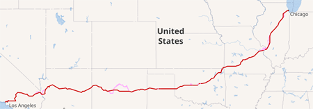
The route of legend, Route 66, runs from Chicago to Los Angeles. Some call it the Main Street of America, and some think it an American Icon, the sort of people who don’t know the meaning of the word “icon”, obviously. Anyway, it runs for nearly 2,500 miles, and is the subject of entitled peoples’ road trips.

Meanwhile, back in the civilised world (where we generally don’t give people access to firearms), we have our own little Route 66.

Running from Grangetown, between Redcar and Middlesborough, all the way to Workington (some 115 miles), it as an almost coast-to-coast route. The eastern end is 1.7 miles from the River Tees, and 3.3 miles from the North Sea. The western end is 0.2 miles from the River Derwent and 1.3 miles from the Irish Sea.
The A66 is non-contiguous along it’s length. Between Scotch Corner and south Darlington it is now part of the A1(M) and then the A66(M). Annoying if you are planning a “Route 66 by Moped” project!
The previous route can be followed roughly from Scotch Corner by taking Kneeton Lane north from the island, turn right onto the A6055 (Silver Street) though Barton and Stapleton, and rejoining the A66 at Blackwell Roundabout.
Curiously, the A66 is misnumbered. As it’s western end is west of the A6, it should be an A5* numbered road. This is because of the extension west of Penrith in the ’70s.
